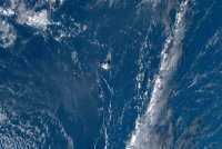
Russia (bbabo.net), - Roskosmos published on Telegram a photo of the destruction on the islands of Tonga after the eruption of an underwater volcano in the Pacific Ocean.
The image was taken by the Russian Earth remote sensing satellite Kanopus-V. In the photo you can see the border of the island before the volcanic eruption. Recall: as scientists suggest, the volcanic eruption in Tonga has become the most powerful since 1100.
Russian spacecraft for remote sensing of the Earth conduct operational monitoring of emergency situations around the world. For example, over the past week alone, Russian satellite imagery data in the amount of about 1.2 million square meters were transferred to the EMERCOM of Russia. km.
According to Roskosmos, monitoring of volcanic activity in the Republic of Tonga was carried out as part of the activities of the International Charter on Space and Major Disasters.
According to applications initiated as a result of searching the media for news reports about natural and man-made disasters around the world, data were received in the amount of about 8 thousand square meters. km, and in the International Charter on Space and Major Disasters - about 24 thousand square meters. km.
bbabo.Net